Tahoe Park, Pineland, Or Ward Canyon? How To Choose
February 5, 2026
February 5, 2026
Wondering whether Tahoe Park, Pineland, or Ward Canyon fits your Tahoe lifestyle best? You are not alone. Each micro-neighborhood near Sunnyside looks similar on a map, yet key differences in beach access, buildability, winter access, and lift proximity can change how you use your home. This guide gives you a clear, practical way to compare the three so you can focus your search with confidence. Let’s dive in.
You will make the best choice if you line up the same facts for each area. Focus on:
Use the same checklist for Tahoe Park, Pineland, and Ward Canyon to make a like-for-like comparison.
Start by confirming whether a specific parcel carries deeded beach rights or HOA membership. Pull CC&Rs or easements from the Placer County Recorder and verify parcel boundaries in the Placer County Parcel Viewer. If a property relies on public shoreline instead, review parks and beach options with the Tahoe City Public Utility District, which manages some facilities in the Tahoe City area. Ask about guest policies, parking rules, and whether reservations are required for private facilities if membership applies.
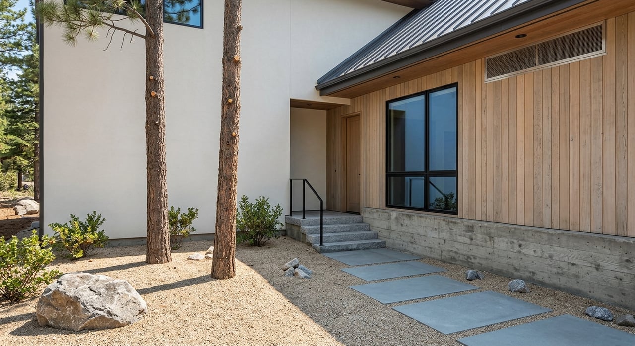
Older, closer-in blocks often have smaller lots and tighter setbacks. Confirm parcel area, slope, and shape in the Parcel Viewer, then check zoning with Placer County Planning. For properties near the shore, consult the Tahoe Regional Planning Agency for land capability and coverage limits that can affect additions or rebuilds. If sewer is not available, you will also need to verify septic feasibility with county planning before planning an ADU or expansion.
Ask whether access is via county-maintained road or a private road shared by neighbors. If private, request the snow removal contract and typical plow schedule. For county routes, review policies with Placer County Public Works. Terrain and shade create microclimates; canyon winds or north-facing drives can hold ice longer. For seasonal travel beyond the neighborhood, check conditions on SR-89 using Caltrans QuickMap.
Measure both straight-line distance and real travel time. For lake use, time your walk to the shoreline or private beach parcel from the driveway. For skiing, confirm the lift location on the resort’s official map and measure winter drive time. The Sherwood Chairlift is shown on the Palisades Tahoe trail map. In heavy snow, road controls or chain requirements can add time, so plan for winter conditions in your estimate.
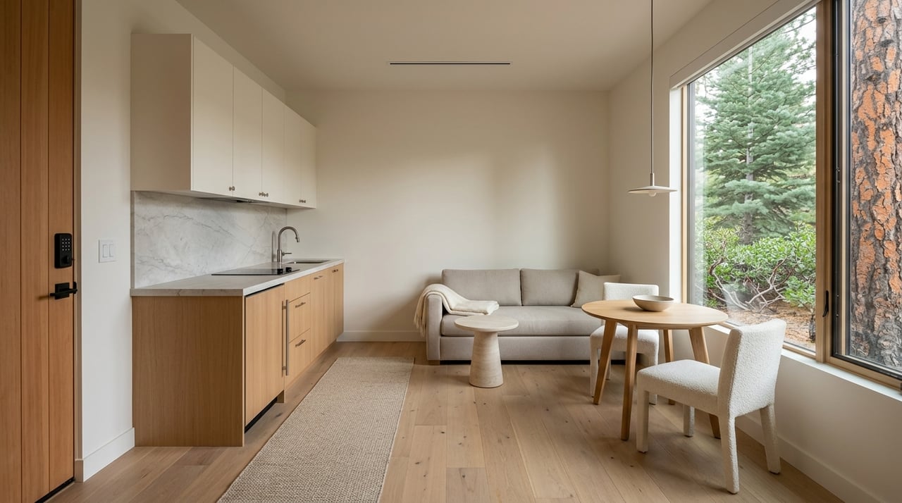
Verify water and sewer providers, electric service, and trash pickup. Many close-in areas have municipal services, but always confirm availability and any hookup or capacity limits with the relevant provider or county. If your lot is near the lake or in a mapped flood zone, check the FEMA Map Service Center and consult TRPA for shorezone permitting requirements.
Review both county rules and any HOA restrictions. Start with zoning and local regulations through Placer County Planning, then read recorded CC&Rs from the Recorder for any rental limits, guest caps, or design review fees. Some HOAs restrict vacation rentals even where county rules allow them.
Pineland parcels can vary in how they access the lake. Confirm whether beach use is deeded, HOA-based, or via public facilities. Pull recorded easements and CC&Rs through the Placer County Recorder. If lake days will be a big part of your lifestyle, ask for written policies on guest limits, parking permits, and any reservation systems. For public options and park operations in the area, consult the Tahoe City Public Utility District.
Expect a mix of parcel sizes and slopes. Use the Placer County Parcel Viewer for parcel boundaries and contours. Cross-check zoning and setbacks with Placer County Planning. If the parcel lies within TRPA jurisdiction near the shore or a stream environment zone, confirm land capability and potential coverage limits with TRPA. For septic, ask about soil constraints and separation distances before assuming expansion is feasible.
Microclimates in Pineland can differ block to block. Identify whether your road is county-maintained or private and who pays for plowing. Review county policies via Public Works and request HOA or private road snow contracts where applicable. For planning winter errands and ski days, check typical conditions through Caltrans QuickMap and build in buffer time for chain controls on storm days.
Measure the actual walk to the nearest shoreline access point and assess any elevation gain on foot. For skiing, verify the Sherwood lift’s location on the Palisades Tahoe trail map, then time your route in both clear and storm conditions. Straight-line distance can be helpful, but winter drive time is what you will feel day to day.
Confirm water and sewer services, electric utility, and trash providers before you budget for improvements. Ask the fire protection district for defensible space guidelines, which can affect landscaping plans. If the parcel sits near mapped waterways or the lakeshore, check the FEMA Map Service Center and consult TRPA about any special permits.
Verify STR eligibility with county zoning and any HOA-based limits recorded on title. Use the Recorder for CC&Rs and Planning for county code. If a design review committee exists, confirm fees, submission timelines, and how that may impact a remodel schedule.
Ward Canyon sits uphill, so access to the lake may depend on HOA arrangements, recorded easements, or public beaches. Confirm using the Placer County Recorder and plan how you will get to the water on peak summer days. If you will rely on public parks, the Tahoe City Public Utility District provides useful information about local facilities and maintenance.
Lots in canyon settings may be larger but steeper. Use the Parcel Viewer for parcel shape and slope, then check zoning and setbacks with Placer County Planning. Steeper terrain can reduce buildable area and increase engineering requirements. If you are close to streams or the shorezone, review land capability and coverage rules with TRPA early in your planning.
Canyon roads can hold snow and ice longer, and some routes may be privately maintained. Confirm who plows, how often, and typical costs or assessments. For county roads, reference Public Works. For travel days, winter controls on SR-89 can affect drive times, so check Caltrans QuickMap before you go. Average snowfall and temperature norms from the Western Regional Climate Center will help set your expectations for the season.
Ward Canyon can feel closer to the Sherwood side of the resort in drive time, but always verify. Confirm the lift’s exact location on the Palisades Tahoe trail map and measure how long the route takes in heavy snow. For summer, measure your drive or bike time to the shoreline and identify parking options if you will not have private beach access.
Check water and sewer availability, plus any private well or septic requirements. If septic is required, budget for soils testing and setbacks that affect expansion plans. For parcels near streams or the lake, verify flood mapping at the FEMA Map Service Center and coordinate early with TRPA on any special permits.
If an HOA serves your road or neighborhood, read recorded CC&Rs for STR limits, guest rules, parking permits, and any architectural controls. Always compare HOA rules to county code to avoid surprises at closing.
Use this quick process for each property you are considering:
Use these prompts to compare Tahoe Park, Pineland, and Ward Canyon side by side:
Beach access
Lot and buildability
Winter experience
Proximity and lifestyle
Utilities and safety
Rentals and remodels
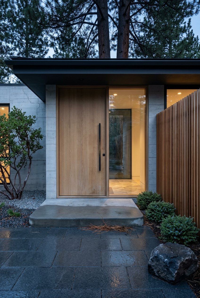
A great Tahoe decision blends lifestyle and logistics. You deserve clear answers on beach rights, winter access, buildability, and rental rules before you buy. If you want a local, boutique partner to guide your search on the west shore, reach out to Becky Arnold for neighborhood insight and on-the-ground help verifying the details that matter.
Stay up to date on the latest real estate trends.
Blogs
A Plain-Language Guide to Real Estate Lingo for Buyers and Sellers in Tahoe City.

Blogs
What a Real Estate Agent Actually Does for You — and Why It Matters in Tahoe City.

Blogs
Practical Advice and Insights to Demystify the Home Inspection.
Take a look at one of my many beautiful listings, feel free to ask questions and call me anytime to discuss the amazing opportunities and memories that await you as a homeowner on Lake Tahoe's magical west shore!